Results
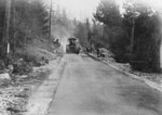
- View of men and construction machinery paving Marine Drive.View of men and construction machinery paving Marine Drive.
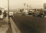
- A street view looking West up the 1300 block of Marine Drive. An Imperial Service Station sign can be seen in the image along with numerous automobiles.A street view looking West up the 1300 block of Marine Drive. …
- A street view of a house located at 1768 Inglewood Avenue. A Prudential Fine Homes/Sussex Realty sign can be seen at the entrance to the driveway.A street view of a house located at 1768 Inglewood Avenue. A …
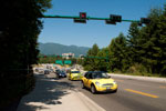
- The exit onto Lions Gate Bridge from West and North Vancouver. Numerous automobiles can be seen including a Mini Cooper, A Toyota taxi, and a Volkswagen.The exit onto Lions Gate Bridge from West and North Vancouver. Numerous …
- A view of a city bus heading East on Marine drive. The bus's banner reads "sorry," which is continued by "not in service".A view of a city bus heading East on Marine drive. The …
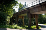
- A view, looking East, of the railway bridge that runs over Westport Road.A view, looking East, of the railway bridge that runs over Westport …
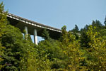
- A view from the Seaview Walk of the Trans-Canada/Upper Levels Highway Overpass near the Horseshoe Bay exit.A view from the Seaview Walk of the Trans-Canada/Upper Levels Highway Overpass …
- View of Taylor Way, the Upper Levels Highway and the British Properties. Photographed August 27, 2012 for the District of West Vancouver Centennial Year. Geolocation: Lat: 49.326325 Long: -123.134862View of Taylor Way, the Upper Levels Highway and the British Properties. …
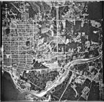
- An aerial photograph of West Vancouver in the Taylor Way area. The image spans from Lions Gate Bridge and Capilano River to approximately 14th Street and North to the Upper Levels Highway and BritishAn aerial photograph of West Vancouver in the Taylor Way area. The …
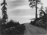
- View of suicide bend on Marine Drive with Point Atkinson Lighthouse in distance. Contributed by Amy Larnder.View of suicide bend on Marine Drive with Point Atkinson Lighthouse in …
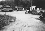
- A view of Horseshoe Bay in the 1930's. Three buildings can be seen including the General Store and Homes Gas. An old delivery truck that has Hazelwood Ice Cream is also visible parked on the dirt roaA view of Horseshoe Bay in the 1930's. Three buildings can be …
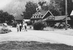
- A view of Bay Street in Horseshoe Bay. "The Chalet" can be seen in the background advertising rooms, lunch, teas, and dinners along with four people walking up the dirt road in front of the building.A view of Bay Street in Horseshoe Bay. "The Chalet" can be …
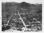
- An aerial view of North Vancouver which looks East from Mahon Park. The photograph was most likely taken in the 1920's-1930's.An aerial view of North Vancouver which looks East from Mahon Park. …
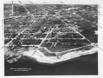
- An aerial view of North Vancouver waterfront between St. Andrews and St. Davids. The photograph was most likely taken in the 1920's-1930's.An aerial view of North Vancouver waterfront between St. Andrews and St. …
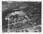
- An aerial view of North Vancouver looking North to Mahon Park, it also includes Keith Road to 23rd Street. The photograph was most likely taken in the 1920's-1930's.An aerial view of North Vancouver looking North to Mahon Park, it …
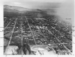
- An aerial view of North Vancouver which includes Lonsdale looking North from 8th Street and the North Shore Mountains. The photograph was most likely taken in the 1920's-1930's.An aerial view of North Vancouver which includes Lonsdale looking North from …
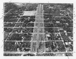
- An aerial view of North Vancouver which includes 8th Street to 17th Street and Grand Boulevard. The photograph was most likely taken in the 1920's-1930's.An aerial view of North Vancouver which includes 8th Street to 17th …
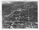
- An aerial view of North Vancouver which includes 11th Street to 21st Street, Lonsdale, and St. George. The photograph was most likely taken in the 1920's-1930's.An aerial view of North Vancouver which includes 11th Street to 21st …
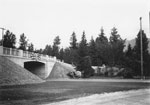
- The Northeast side of the Marine Drive overpass from Lions Gate Bridge. The Henderson house is also visible, still standing, beside the overpass.The Northeast side of the Marine Drive overpass from Lions Gate Bridge. …
- View of Memorial Park and Marine Drive.View of Memorial Park and Marine Drive.
We are grateful for the generous support of the British Columbia History Digitization Program, Friends of the West Vancouver Memorial Library, West Vancouver Historical Society and Young Canada Works.
© 2019 West Vancouver Memorial Library | Website by Affinity Bridge


