Results


Page 2 of 4
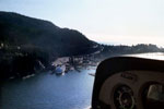
- Aerial view of North Vancouver harbour looking up Brooksbank Avenue at Main Street.Aerial view of North Vancouver harbour looking up Brooksbank Avenue at Main …
- Aerial view of the Royal Vancouver Yacht Club Jericho location.Aerial view of the Royal Vancouver Yacht Club Jericho location.
- Aerial view of downtown Vancouver, Lost Lagoon, and English Bay. Burrard Inlet and North Vancouver can also be seen in the distance.Aerial view of downtown Vancouver, Lost Lagoon, and English Bay. Burrard Inlet …
- Aerial view of Lions Gate Bridge, Burrard Inlet, and North Vancouver. The North Shore mountains are also visible in the distance.Aerial view of Lions Gate Bridge, Burrard Inlet, and North Vancouver. The …
- Aerial view of Horseshoe Bay and the Ferry terminal.Aerial view of Horseshoe Bay and the Ferry terminal.
- Aerial view of Whyte Islet Park and Whytecliff Park.Aerial view of Whyte Islet Park and Whytecliff Park.
- Aerial view of the Stanley Park seawall and Siwash Rock.Aerial view of the Stanley Park seawall and Siwash Rock.
- Aerial view of downtown Vancouver at Cardero Street.Aerial view of downtown Vancouver at Cardero Street.
- Aerial view of Onion Island, located just off the Southwest bay of Bowen Island.Aerial view of Onion Island, located just off the Southwest bay of …
- Aerial view of English Bay, downtown Vancouver, North Vancouver, and the North Shore Mountains.Aerial view of English Bay, downtown Vancouver, North Vancouver, and the North …
- Aerial view of Lions gate Bridge looking East to downtown Vancouver and Burrard Inlet. Piles of yellow sulfur can be seen at a North Vancouver terminal on the left.Aerial view of Lions gate Bridge looking East to downtown Vancouver and …
- Aerial view of Vancouver Harbour including Deadman's Island, Vancouver Yacht Club, Lost Lagoon, Downtown Vancouver, and Point Grey in the distance.Aerial view of Vancouver Harbour including Deadman's Island, Vancouver Yacht Club, Lost …
- Aerial view of Deep Cove looking East towards Grey Rocks Island, boats can be seen just off the shoreline along with many docks.Aerial view of Deep Cove looking East towards Grey Rocks Island, boats …
- Aerial view of Stanley Park, Burrard Inlet, Deadman's Island, and Canada Place.Aerial view of Stanley Park, Burrard Inlet, Deadman's Island, and Canada Place.
- Aerial view of the Burrard Street bridge, Granville Street bridge, and English Bay.Aerial view of the Burrard Street bridge, Granville Street bridge, and English …
- Aerial view of Canada Place, B.C. Place, and downtown Vancouver.Aerial view of Canada Place, B.C. Place, and downtown Vancouver.
- Aerial view of Vancouver Harbour including Deadman's Island, Vancouver Yacht Club, Lost Lagoon, Downtown Vancouver, and Point Grey in the background.Aerial view of Vancouver Harbour including Deadman's Island, Vancouver Yacht Club, Lost …
- Aerial view of Stanley Park, Deadman's Island, Vancouver Yacht Club, and Lost Lagoon. Point Grey can be seen in the distance.Aerial view of Stanley Park, Deadman's Island, Vancouver Yacht Club, and Lost …
- Aerial view of Canada Place and downtown Vancouver. A large boat can be seen moored along side Canada Place.Aerial view of Canada Place and downtown Vancouver. A large boat can …
- West Vancouver Memorial Library NewsletterWest Vancouver Memorial Library Newsletter
Page 2 of 4


