Results
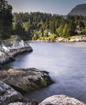
- Caulfeild Cove from the shores of Lighthouse Park, photographed July 10, 2012 for the District of West Vancouver Centennial Year. Geolocation: Lat: 49.337637 Long: -123.253706.Caulfeild Cove from the shores of Lighthouse Park, photographed July 10, 2012 …
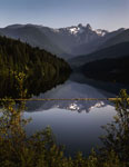
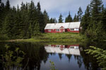
- Capilano Lake looking towards the Lions photographed July 10, 2012 for the District of West Vancouver Centennial Year. View of the Lions reflected in the lake with a strong vista of the treed shoreliCapilano Lake looking towards the Lions photographed July 10, 2012 for the …
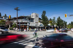
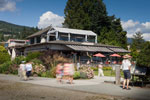
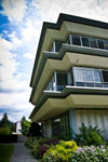
- Marketplace IGA with residential condominiums above, 2491 Marine Drive, previously Stong’s, and prior to that, Charlton’s Market. Photographed July 16, 2012 for the District of West Vancouver CenMarketplace IGA with residential condominiums above, 2491 Marine Drive, previously Stong’s, and …
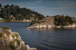
- View of Whyte Islet from the shores of Whytecliff Park. Photographed July 16, 2012 for the District of West Vancouver Centennial Year. Geolocation: Lat: 49.370637 Long: -123.291857.View of Whyte Islet from the shores of Whytecliff Park. Photographed July …
- View of Marine Drive at 15th Street. Photographed July 16, 2012 for the District Centennial Year. Geolocation: Lat: 49.328506 Long: -123.158283.View of Marine Drive at 15th Street. Photographed July 16, 2012 for …
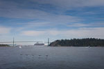
- Looking east to the Lions Gate Bridge. Photograph shows cruise ship passing under the bridge with various pleasure craft and geese in foreground. Photographed August 1, 2012 for the District of WestLooking east to the Lions Gate Bridge. Photograph shows cruise ship passing …
- Northwest corner of 22nd Street and Marine Drive (2203 Marine Drive) under construction for seniors residence. Former site of Wetmore Motors. Photographed July 12, 2012 for the District of West VancoNorthwest corner of 22nd Street and Marine Drive (2203 Marine Drive) under …
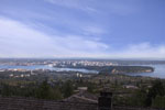
- View of West Vancouver from Prospect Point. Photographed July 2012 for the District Centennial Year. Geolocation: Lat: 49.313772 Long: -123.141997.View of West Vancouver from Prospect Point. Photographed July 2012 for the …
- View of Taylor Way, the Upper Levels Highway and the British Properties. Photographed August 27, 2012 for the District of West Vancouver Centennial Year. Geolocation: Lat: 49.326325 Long: -123.134862View of Taylor Way, the Upper Levels Highway and the British Properties. …
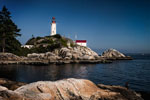
- View of Point Atkinson Lighthouse from the shores of Lighthouse Park. Photographed July 10, 2012 for the District of West Vancouver Centennial Year. Geolocation: Lat: 49.329891 Long: -123.264992View of Point Atkinson Lighthouse from the shores of Lighthouse Park. Photographed …
- Beach House Restaurant, 150 25th Street, photographed July 31, 2012 for the District of West Vancouver Centennial Year. Geolocation: Lat. 49.333317 Long: -123.182155.Beach House Restaurant, 150 25th Street, photographed July 31, 2012 for the …
- View of children's baseball game with several spectators. Photographed July 24, 2012 for the District of West Vancouver Centennial Year. Sign on fence reads "Play Baseball with Cypress Park Little LeView of children's baseball game with several spectators. Photographed July 24, 2012 …
- View of Vancouver from British Properties. Photographed July 31, 2012 for the District of West Vancouver Centennial Year. Geolocation: Lat: 49.355824 Long: -123.148327View of Vancouver from British Properties. Photographed July 31, 2012 for the …
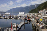
- Horseshoe Bay with view of docks and ferries. Photographed August 17, 2012 for the District of West Vancouver Centennial Year. Geolocation: Lat: 49.375747 Long: -123.271987Horseshoe Bay with view of docks and ferries. Photographed August 17, 2012 …
- View of Hollyburn Lodge photographed in August 1, 2012 for District of West Vancouver Centennial Year. Geolocation: Lat: 49.375541 Long: -123.184633.View of Hollyburn Lodge photographed in August 1, 2012 for District of …
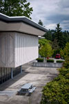
- A street view of the West Vancouver Municipal Hall located at 750 17th Street.A street view of the West Vancouver Municipal Hall located at 750 …
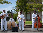
- El Grupo Cubano performing a summer concert at Ambleside Pier in front of the Ferry Building.El Grupo Cubano performing a summer concert at Ambleside Pier in front …
- A view of the West Vancouver Municipal Hall courtyard located at 750 17th Street.A view of the West Vancouver Municipal Hall courtyard located at 750 …
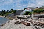
- A view from the shore of houses along the waterfront of Ambleside Beach.A view from the shore of houses along the waterfront of Ambleside …
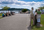
- A view of spectators enjoying a free summer concert at Ambleside Pier.A view of spectators enjoying a free summer concert at Ambleside Pier.
We are grateful for the generous support of the British Columbia History Digitization Program, Friends of the West Vancouver Memorial Library, West Vancouver Historical Society and Young Canada Works.
© 2019 West Vancouver Memorial Library | Website by Affinity Bridge


