Results
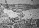
- Plan of West Vancouver subdivision prepared by Irwin & Billings, realtors of North Vancouver. Plan shows a proposed tunnel in location of Lions Gate Bridge. Proposed subdivision is in Dundarave Area.Plan of West Vancouver subdivision prepared by Irwin & Billings, realtors of …
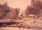
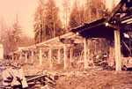
- View of construction site for Capilano Bridge. Bridge built with timber and some of the original foundations built from logs seen in foreground.View of construction site for Capilano Bridge. Bridge built with timber and …
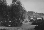
- View titled "Industrial flat lands of West and North Vancouver." Exact location of photo is difficult to identify.View titled "Industrial flat lands of West and North Vancouver." Exact location …
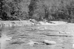
- View looking north of Capilano River. Exact location of photo is not specified.View looking north of Capilano River. Exact location of photo is not …
- View of Crown Mountain (on left) from site of Capilano Golf Club.View of Crown Mountain (on left) from site of Capilano Golf Club.
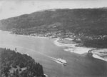
- Aerial view of First Narrows with ferry heading up Burrard Inlet. Stanley Park in foreground and West Vancouver in midground.Aerial view of First Narrows with ferry heading up Burrard Inlet. Stanley …
- View of front porch of an unidentified house in West Vancouver. Group of seven men sitting on porch.View of front porch of an unidentified house in West Vancouver. Group …
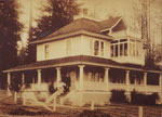
- View of Vinson House, 1524 Gordon Avenue. House was built in 1913 by V.V. Vinson. Print from which this scan was made has damage to the lower left corner and is missing a section.View of Vinson House, 1524 Gordon Avenue. House was built in 1913 …
- View of house at corner of 16th Street and Esquimalt Avenue. House was built circa 1910 by Mr. and Mrs. John Hart. The two people on the front stairs and not identified in the original cataloguing noView of house at corner of 16th Street and Esquimalt Avenue. House …
- View of house and garden at 22nd Street and Mathers Avenue. House belonged to J.J. Hanna.View of house and garden at 22nd Street and Mathers Avenue. House …
- View of timbre supports for Capilano River Bridge.View of timbre supports for Capilano River Bridge.
- View of construction of Capilano River Bridge. Photo shows logs spanning concrete pillars.View of construction of Capilano River Bridge. Photo shows logs spanning concrete …
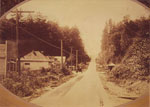
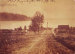
- View looking east along Esquimalt Avenue from 15th Street. Original label on photograph reads: "Taylor Road now Esquimalt Avenue." Horse drawn carriage approaching photo along the road can also be seView looking east along Esquimalt Avenue from 15th Street. Original label on …
- View of two grass tennis courts near waterfront. Original cataloguing note indicates this is John Lawson Park. This may be the location of the present park but the photo appears to predate the creatiView of two grass tennis courts near waterfront. Original cataloguing note indicates …
- View looking towards the shore on Dundarave Pier. Group of children swimming in water and on pier. St. Mawes Hotel is visible in the background. The St. Mawes Hotel building is also known as the ClacView looking towards the shore on Dundarave Pier. Group of children swimming …
- Street view of Marine Drive looking west from 25th Street. Store on left with false front was Dundarave Butcher Shop. Small structure on right of Marine Drive was a bus shelter.Street view of Marine Drive looking west from 25th Street. Store on …
- View of 17th Street between Marine Drive and Bellevue Avenue. John Lawson's Real Estate office on left and first West Vancouver general store on right.View of 17th Street between Marine Drive and Bellevue Avenue. John Lawson's …
- View looking towards Burrard Inlet and Stanley Park of early Ambleside development and businesses.View looking towards Burrard Inlet and Stanley Park of early Ambleside development …
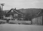
- View of house on 17th Street. Photo taken from parking lot in front of house and shows house frontage and side yard with garage on right of photo.View of house on 17th Street. Photo taken from parking lot in …
- View looking south along 17th Street from Esquimalt Avenue. Original caption on photo reads: "17th Street Ferry Wharf November 1909 - July 1912"View looking south along 17th Street from Esquimalt Avenue. Original caption on …


