Home (Advanced Search) → Results Help

Results

We found
75
matching items
  • Remove search term Geographic Location: Capilano River
Page 1 of 4
1234 → Next
  • Pacific Great Eastern Railway
    Pacific Great Eastern Railway Image
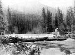
        View of construction of Pacific Great Eastern Railway bridge over Capilano River.
      View of construction of Pacific Great Eastern Railway bridge over Capilano River.
  • Capilano River Bridge (original)
    Capilano River Bridge (original) Image
        View of Capilano River Bridge. Original cataloging note states that this is the "Original Capilano Bridge into West Vancouver" perhaps pre-dating 1915 bridge.
      View of Capilano River Bridge. Original cataloging note states that this is ...
  • Capilano River Bridge Washout
    Capilano River Bridge Washout Image
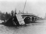
        View of collapsed Capilano River Bridge after 1917 flood.
      View of collapsed Capilano River Bridge after 1917 flood.
  • Pacific Great Eastern Railway
    Pacific Great Eastern Railway Image
        View of concrete pillars during construction of bridge over Capilano River.Original note supplied by photographer: The new Pacific Great Eastern railway bridge over the Capilano river is beginning to take shape. These two massive concrete piers are on the west bank. Also seen across the river is a crane pouring ...
      View of concrete pillars during construction of bridge over Capilano River.Original note ...
  • Capilano River Bridge
    Capilano River Bridge Image
        View of crane moving bridge parts during construction of bridge over Capilano River connecting North Vancouver to Park Royal.
      View of crane moving bridge parts during construction of bridge over Capilano ...
  • Capilano River Bridge
    Capilano River Bridge Image
        View of Capilano River Bridge during construction. Bridge connects North Vancouver to Park Royal.
      View of Capilano River Bridge during construction. Bridge connects North Vancouver to ...
  • Capilano Care Centre
    Capilano Care Centre Image
        View of Capilano Care Centre, formerly known as Beacon Hill Lodge, 525 Clyde Avenue. Building located on bank of Capilano River.
      View of Capilano Care Centre, formerly known as Beacon Hill Lodge, 525 ...
  • Capilano Lake
    Capilano Lake Image
        Capilano Lake looking towards the Lions photographed July 10, 2012 for the District of West Vancouver Centennial Year. View of the Lions reflected in the lake with a strong vista of the treed shoreline. Geolocation: Lat: 49.360143 Long: -123.108373.
      Capilano Lake looking towards the Lions photographed July 10, 2012 for the ...
  • Second Bridge Construction
    Second Bridge Construction Image
        Second bridge construction over the Capilano River near Park Royal.
      Second bridge construction over the Capilano River near Park Royal.
  • Aerial Photo of West Vancouver & North Vancouver
    Aerial Photo of West Vancouver & North Vancouver Image
        An aerial photograph of West Vancouver and North Vancouver. The image spans from approximately 19 Street (West Van) to Fell Avenue (North Van) and North past the Upper Levels Highway to Cleveland Dam. Image taken after Park Royal South construction.
      An aerial photograph of West Vancouver and North Vancouver. The image spans ...
  • Aerial Photo of West Vancouver (Park Royal)
    Aerial Photo of West Vancouver (Park Royal) Image
        An aerial photograph of West Vancouver in the Ambleside area. The image spans from Capilano Road to approximately 14th Street and North to Inglewood Avenue. Image taken after Park Royal South construction.
      An aerial photograph of West Vancouver in the Ambleside area. The image ...
  • Aerial Photo of West Vancouver (Taylor Way)
    Aerial Photo of West Vancouver (Taylor Way) Image
        An aerial photograph of West Vancouver in the Taylor Way area. The image spans from Lions Gate Bridge and Capilano River to approximately 14th Street and North to the Upper Levels Highway and British Properties. Image from before construction of Park Royal South.
      An aerial photograph of West Vancouver in the Taylor Way area. The ...
  • Mouth of the Capilano River
    Mouth of the Capilano River Image
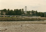
        A view of the mouth of the Capilano River flowing out into Burrard Inlet. A bridge used by trains can be seen over the river.
      A view of the mouth of the Capilano River flowing out into ...
  • Capilano Travel Trailer Park
    Capilano Travel Trailer Park Image
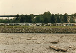
        View of the east bank of the Capilano River showing mobile homes in the Capilano Travel Trailer Park at 295 Tomahawk Avenue.
      View of the east bank of the Capilano River showing mobile homes ...
  • Capilano Travel Trailer Park
    Capilano Travel Trailer Park Image
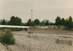
        View of mobile homes along eastern bank of Capilano River next to the overpass from Park Royal Shopping Center. Image also shows the top of the Plaza International building in the background.
      View of mobile homes along eastern bank of Capilano River next to ...
  • Fullerton Avenue Bridge
    Fullerton Avenue Bridge Image
        View of bridge over Capilano River at Fullerton Avenue. Photo taken from Woodcroft Apartment Complex.
      View of bridge over Capilano River at Fullerton Avenue. Photo taken from ...
  • Capilano River Flood
    Capilano River Flood Image
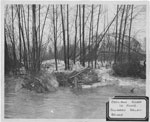
        View of flooded Capilano River looking through trees to collapsed Capilano River Bridge. Note from original catalogue states that a Bailey Bridge was built alongside to handle traffic. Original print has a sticker label.
      View of flooded Capilano River looking through trees to collapsed Capilano River ...
  • Municipal Sanitation/Works Yard
    Municipal Sanitation/Works Yard Image
        A view of the Municipal Sanitation/Works Yard located at 101 Bridge Road near the mouth of the Capilano River. Lions Gate Bridge is also visible in the left side of the image.
      A view of the Municipal Sanitation/Works Yard located at 101 Bridge Road ...
  • Municipal Sanitation/Works Yard
    Municipal Sanitation/Works Yard Image
        A view of the Municipal Sanitation/Works Yard located at 101 Bridge Road near the mouth of the Capilano River.
      A view of the Municipal Sanitation/Works Yard located at 101 Bridge Road ...
  • Municipal Sanitation/Works Yard
    Municipal Sanitation/Works Yard Image
        A view of the Municipal Sanitation/Works Yard located at 101 Bridge Road near the mouth of the Capilano River.
      A view of the Municipal Sanitation/Works Yard located at 101 Bridge Road ...
Page 1 of 4
1234 → Next
Sort
Ordered by
: Relevance
  • Relevance
  • Title (0-9, Z-A)
  • Oldest date (to newest)
  • Newest date (to oldest)
  • Date added (newest first)
Contributors
  • West Vancouver Memorial Library (75)
Media Types
  • Image (75)
Featured Collections
  • McPhee Collection (15)
  • Helen Theilmann (3)
  • Park Royal Collection (1)
Subjects
  • Bridges (46)
  • Rivers (42)
  • Construction (18)
  • Floods (16)
  • Aerial Photos (6)
  • Canyons (5)
  • Buildings (4)
  • Capilano RV Park (4)
  • Capilano River (4)
  • Pacific Great Eastern Railway (4)
  • Park Royal (4)
  • Railroads (4)
  • Beaches (3)
  • Flumes (3)
  • Roads (3)
  • Scenic Views (3)
  • Shingle Bolts (3)
  • Apartment Buildings (2)
  • Capilano Care Centre (2)
  • Capilano Dam (2)
  • Dams (2)
  • Logging (2)
  • Waterfront (2)
  • Ambleside (1)
  • Ceremonies (1)
  • Children (1)
  • Dogs (1)
  • Forests (1)
  • Groups (1)
  • Houses (1)
  • Lighthouses (1)
  • Men (1)
  • Mountains (1)
  • Panoramas (1)
  • Parks (1)
  • Portraits (1)
  • S.S. Princess Kathleen (1)
  • Seawalls (1)
  • Shopping Malls (1)
  • Siwash Rock (1)
  • Steamboats (1)
  • Waterfalls (1)
  • Waterworks (1)
  • Winter (1)
Item Types
  • Photographs (75)
Years
1880s1880188118821883188418851886188718881889
18901890189118921893189418951896189718981899
1900s1900190119021903190419051906190719081909
1910s1910191119121913191419151916191719181919
1920s1920192119221923192419251926192719281929
1930s1930193119321933193419351936193719381939
1940s1940194119421943194419451946194719481949
1950s1950195119521953195419551956195719581959
19601960196119621963196419651966196719681969
1970s1970197119721973197419751976197719781979
1980s1980198119821983198419851986198719881989
1990s1990199119921993199419951996199719981999
20002000200120022003200420052006200720082009
2010s2010201120122013201420152016201720182019
Map
Map of locations associated with these pictures. Click on a balloon to do a geographic search.
Web Tools
See Alternate Formats
Atom | RSS | Dublin Core | Mods | Solr
Home (Advanced Search) → Results → Top Help
We are grateful for the generous support of the British Columbia History Digitization Program, Friends of the West Vancouver Memorial Library, West Vancouver Historical Society and Young Canada Works.
© 2019 West Vancouver Memorial Library | Website by Affinity Bridge
Powered by / Alimenté par VITA Toolkit
Privacy Policy