Results
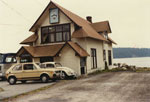
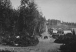
- View of West Vancouver Bus Terminal, foot of 14th Street. Building formerly used as ferry building.View of West Vancouver Bus Terminal, foot of 14th Street. Building formerly …
- View looking from back of West Vancouver Odeon Theatre into residential neighborhood. Backyards of Marine Drive alley are in foreground.View looking from back of West Vancouver Odeon Theatre into residential neighborhood. …
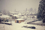
- View looking from back of West Vancouver Odeon Theatre into residential neighborhood. Backyards of Marine Drive alley are in foreground and there is snow on the ground.View looking from back of West Vancouver Odeon Theatre into residential neighborhood. …
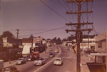
- High angle view of businesses and stores along Marine Drive near 16th Street.High angle view of businesses and stores along Marine Drive near 16th …
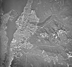
- An aerial photograph of West and North Vancouver, downtown Vancouver, Iron Worker's Memorial Bridge, Lions Gate Bridge, Stanley Park, Cypress Mountain, Grouse Mountain, and the Strait of Georgia.An aerial photograph of West and North Vancouver, downtown Vancouver, Iron Worker's …
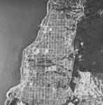
- An aerial photograph of the West Vancouver shoreline towards Dundarave.An aerial photograph of the West Vancouver shoreline towards Dundarave.
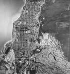
- An aerial photograph of the West Vancouver shoreline towards Dundarave. Ambleside and Park Royal are both visible.An aerial photograph of the West Vancouver shoreline towards Dundarave. Ambleside and …
- View of Ambleside Landing fountain at the foot of 14th Street.View of Ambleside Landing fountain at the foot of 14th Street.
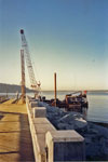
- Construction involving a crane on Ambleside Pier looking towards Stanley Park.Construction involving a crane on Ambleside Pier looking towards Stanley Park.
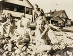
- Portrait of three children sitting on Ambleside Beach with two beach houses in background. Original cataloguing note states that child on right is Frankie Tait Bantron and that the house on the rightPortrait of three children sitting on Ambleside Beach with two beach houses …
- View looking east along Esquimalt Avenue from 15th Street. Original label on photograph reads: "Taylor Road now Esquimalt Avenue." Horse drawn carriage approaching photo along the road can also be seView looking east along Esquimalt Avenue from 15th Street. Original label on …
- View of two grass tennis courts near waterfront. Original cataloguing note indicates this is John Lawson Park. This may be the location of the present park but the photo appears to predate the creatiView of two grass tennis courts near waterfront. Original cataloguing note indicates …
- View looking towards Burrard Inlet and Stanley Park of early Ambleside development and businesses.View looking towards Burrard Inlet and Stanley Park of early Ambleside development …
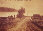
- View looking south along 17th Street from Esquimalt Avenue. Original caption on photo reads: "17th Street Ferry Wharf November 1909 - July 1912"View looking south along 17th Street from Esquimalt Avenue. Original caption on …
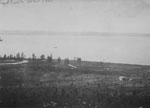
- View of Ambleside area from Sentinel Hill. Land is mostly deforested with one small building in right foreground. Marine Drive cuts through land.View of Ambleside area from Sentinel Hill. Land is mostly deforested with …
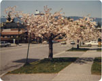
- View from sidewalk of ornamental cherry trees in blossom along 17th Street between Bellevue Avenue and Marine Drive.View from sidewalk of ornamental cherry trees in blossom along 17th Street …
- Street view of a house at 13th Street and Esquimalt Avenue.Street view of a house at 13th Street and Esquimalt Avenue.
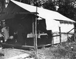
- Tent belonging to Mr. and Mrs. William Frank Merrick on land leased from government at northeast corner of 19th Street and Marine Drive. Tent appears to be a semi-permanent structure with dining tablTent belonging to Mr. and Mrs. William Frank Merrick on land leased …
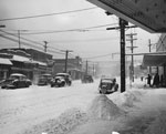
- View of snow on street with cars driving, Marine Drive and 16th Street. Cunningham Drugs and Chevron Gas Station are visible in photo.View of snow on street with cars driving, Marine Drive and 16th …
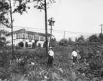
- View of two men standing in cleared building site, corner of Marine Drive and 17th Street. Hollyburn Manor seen in background.View of two men standing in cleared building site, corner of Marine …
We are grateful for the generous support of the British Columbia History Digitization Program, Friends of the West Vancouver Memorial Library, West Vancouver Historical Society and Young Canada Works.
© 2019 West Vancouver Memorial Library | Website by Affinity Bridge


