Results
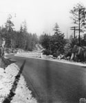
- View looking east along Marine Drive from above rise at Caulfeild. Original cataloging note states that: Dark spot at centre, right of road, is road leading to Cove.View looking east along Marine Drive from above rise at Caulfeild. Original …
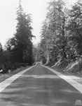
- View looking straight down Marine Drive as it cuts through forest.View looking straight down Marine Drive as it cuts through forest.
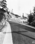
- View of Marine Drive with suicide bend in distance.View of Marine Drive with suicide bend in distance.
- View north looking up Taylor Way at entrance to British Properties.View north looking up Taylor Way at entrance to British Properties.
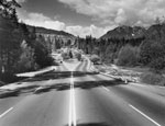
- View of blasted rock faces during construction of Upper Levels Highway.View of blasted rock faces during construction of Upper Levels Highway.
- View of unidentified road in British Properties. Road cuts through forested area. North shore mountains seen in background.View of unidentified road in British Properties. Road cuts through forested area. …
- View of King Georges Way in British Properties. No houses have yet been built along road. Wooden road sign on left side of road.View of King Georges Way in British Properties. No houses have yet …
- View of 17th Street (then known as Lawson Avenue) showing John Lawson's office on left. Photo taken near foot of 17th Street.View of 17th Street (then known as Lawson Avenue) showing John Lawson's …
- View of 17th Street (then known as Lawson Avenue) with John Lawson's office on left and West Vancouver's first paved sidewalk. Photo taken from foot of 17th Street. Original cataloguing note states tView of 17th Street (then known as Lawson Avenue) with John Lawson's …
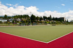
- The West Vancouver Field Hockey Club's Rutledge Field with Marine Drive in the background. The field is located on the edge of Ambleside Park.The West Vancouver Field Hockey Club's Rutledge Field with Marine Drive in …
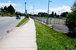
- A view from the South sidewalk looking East down Marine Drive. The Ambleside Park sports fields are visible on the right hand side of Marine.A view from the South sidewalk looking East down Marine Drive. The …
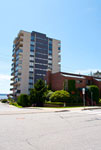
- A street view of apartment buildings at Bellevue Avenue and 18th Street. The highrise is Seawalk Place at 111 18th Street.A street view of apartment buildings at Bellevue Avenue and 18th Street. …
- A view from Thunderbird Marina of the Trans-Canada/Upper Levels Highway Overpass near the Horseshoe Bay exit.A view from Thunderbird Marina of the Trans-Canada/Upper Levels Highway Overpass near …
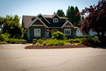
- A street view of a house on the corner of Inglewood Avenue and 20th Street.A street view of a house on the corner of Inglewood Avenue …
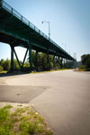
- The underside of Lions Gate Bridge looking towards Burrard Inlet taken from Bridge Road.The underside of Lions Gate Bridge looking towards Burrard Inlet taken from …
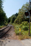
- A view looking West from The Dale road along the train tracks.A view looking West from The Dale road along the train tracks.
- A view looking West from The Dale road along the train tracks.A view looking West from The Dale road along the train tracks.
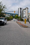
- A street view looking North up 15th Street at Bellevue Avenue towards Sentinel Hill. Numerous apartment buildings, houses, and businesses are visible in the background.A street view looking North up 15th Street at Bellevue Avenue towards …
- A street view looking North up 15th Street at Bellevue Avenue towards Sentinel Hill. Numerous apartment buildings, houses, and businesses are visible in the background.A street view looking North up 15th Street at Bellevue Avenue towards …
- A street view looking North up 16th Street at Marine Drive towards Sentinel Hill. Numerous apartment buildings and houses are visible in the background.A street view looking North up 16th Street at Marine Drive towards …
We are grateful for the generous support of the British Columbia History Digitization Program, Friends of the West Vancouver Memorial Library, West Vancouver Historical Society.


