Results
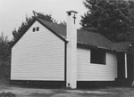
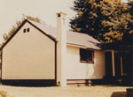
- Photo of sacristy portion of first St. Anthony's church now located behind present rectory.Photo of sacristy portion of first St. Anthony's church now located behind …
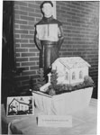
- Image of the cake created for the 60th Anniversary of St. Anthony's Roman Catholic Church. The cake is a replica of the first church shown in image #2376.Image of the cake created for the 60th Anniversary of St. Anthony's …
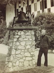
- View of Monsignor Brown, Pastor of St. Anthony's Catholic Church, looking at the church bell mounted outside the church on a stone pedestal. The bell was used in the first St. Anthony's Church.View of Monsignor Brown, Pastor of St. Anthony's Catholic Church, looking at …
- Photo of sacristy portion of first St. Anthony's church now located behind present rectory.Photo of sacristy portion of first St. Anthony's church now located behind …
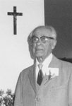
- Portrait shot of Elias Ray, St. Anthony's Roman Catholic Church pioneer born December 17, 1883.Portrait shot of Elias Ray, St. Anthony's Roman Catholic Church pioneer born …
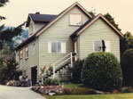
- View of the rectory of St. Anthony's Roman Catholic Church in 1981.View of the rectory of St. Anthony's Roman Catholic Church in 1981.
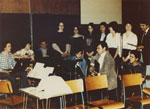
- Photo of Noel Murphy and the 10 am Mass Folk Choir during a 1981 rehearsal.Photo of Noel Murphy and the 10 am Mass Folk Choir during …
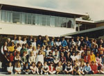
- School photo of Sunday CCD classes at St. Anthony's School. The group includes Grades 1 to 7 outside of St. Anthony's School.Adults identified in the photo are Monsignor J. E. Brown (top row, far lefSchool photo of Sunday CCD classes at St. Anthony's School. The group …
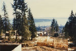
- A view of Ambleside, Stanley Park, and Burrard Inlet from 2357 Hillcrest Road. The construction of a new house occupies the foreground of the photograph.A view of Ambleside, Stanley Park, and Burrard Inlet from 2357 Hillcrest …
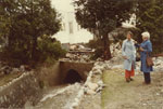
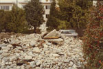
- Two women observing a creek and the damage caused by flooding on October 31, 1981 at 570 18th Street.Two women observing a creek and the damage caused by flooding on …
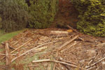
- A view of logs, branches, and damage in a garden caused by a creek flooding on October 31, 1981 at 570 18th Street.A view of logs, branches, and damage in a garden caused by …
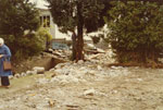
- A view of a creek, damage, and rubble caused by a flood on October 31, 1981 at 570 18th Street. A woman's back can be seen observing the scene in the left edge of the print.A view of a creek, damage, and rubble caused by a flood …
- A view of a parking lot for Ernie's (Kentucky) Take Home at 1783 Marine Drive filled with rubble and damage from a creek flooding on October 31, 1981. A car can be seen in the right corner of the priA view of a parking lot for Ernie's (Kentucky) Take Home at …
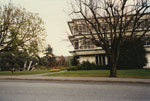
- Street view of West Vancouver Municipal Hall, 750 17th Street.Street view of West Vancouver Municipal Hall, 750 17th Street.
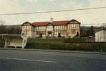
- A street view of the Tudor style Inglewood Centre and YMCA/YWCA located at 1735 Inglewood Avenue.A street view of the Tudor style Inglewood Centre and YMCA/YWCA located …
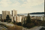
- View from apartment at 17th Street and Esquimalt Avenue. Photo shows West Vancouver Museum & Archives and several apartment buildings.View from apartment at 17th Street and Esquimalt Avenue. Photo shows West …
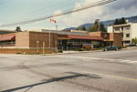
- Street view of West Vancouver Post Office, 225 17th Street.Street view of West Vancouver Post Office, 225 17th Street.
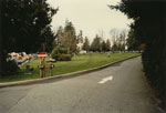
- View of a grassy area of Whytecliff Park. A "keep right" sign is visible along with people socializing on the grass.View of a grassy area of Whytecliff Park. A "keep right" sign …
- Mr. W.D.M. Patterson, chairman of the WVML board from 1976-1977, Donating a Book to the West Vancouver Memorial Library.Mr. W.D.M. Patterson, chairman of the WVML board from 1976-1977, Donating a …
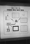
- A poster explaining the ULISYS system to the West Vancouver Memorial Library Public. ULISYS is an automated library control system.A poster explaining the ULISYS system to the West Vancouver Memorial Library …
We are grateful for the generous support of the British Columbia History Digitization Program, Friends of the West Vancouver Memorial Library, West Vancouver Historical Society.


